


Bachelor of Science in Geoinformatics and Geospatial Analytics

 美国
美国
学历文凭
Bachelor Degree

专业院系
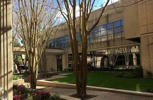
Department of Earth and Atmospheric Sciences

开学时间

课程时长

课程学费

国际学生入学条件
Additional Application Items
Though not required for admission, the following items are strongly encouraged. Please note that all documents must be submitted electronically at this time.
Standardized Test Scores. ACT/SAT scores are not required as part of the admission process. You may choose to submit ACT/SAT scores if you wish. Learn more about SLU's test-optional policy. SLU does not accept superscores so please be sure to send your composite score and all subscores from each completed test. International students are still required to demonstrate English proficiency, which may require the submission of a standardized test score.
Secondary School Report Form. The Secondary School Report Form should be completed by your high school guidance counselor.
Professional R'sum. Please include your name, state and high school on your r'sum.
Letters of recommendation. Letters should be emailed from the recommender to admission@slu.edu, and must include your name, state and high school.
Admission Interview. An admission interview is an opportunity to speak one-on-one with your admission counselor about your specific interests and application.
International English Language Testing System (IELTS) 6.5 , internet-based TOEFL (IBT) 80 , Paper-based TOEFL (PBT) 550
IDP—雅思考试联合主办方

雅思考试总分
6.5
- 雅思总分:6.5
- 托福网考总分:80
- 托福笔试总分:550
- 其他语言考试:Pearson Test of English (PTE) - 54
CRICOS代码:
申请截止日期: 请与IDP联系 以获取详细信息。
课程简介
相关申请
 预科
预科- 奖学金
 实习机会
实习机会- 在校学习
- 跨境学习
- 校园授课-线上开始
- 在线/远程学习
开学时间&学费
学费信息仅供参考,请与IDP联系以获取详细信息
| 开学时间 | 时长 | 学费 | 地点 |
|---|
学校排名

世界排名501
数据源:
泰晤士高等教育世界大学排名

本校相关课程

国际航空一年级
学历文凭
Foundation for Undergraduate
开学日期
课程费用总额

国际航空一年级
学历文凭
Foundation for Undergraduate
开学日期
课程费用总额

国际航空一年级
学历文凭
Foundation for Undergraduate
开学日期
课程费用总额

国际航空航天工程第一年
学历文凭
Foundation for Undergraduate
开学日期
课程费用总额
国际航空航天工程第一年
学历文凭
Foundation for Undergraduate
开学日期
课程费用总额
国际航空航天工程第一年
学历文凭
Foundation for Undergraduate
开学日期
课程费用总额
其他相关课程

空间分析硕士
 多伦多都会大学
学历文凭
Masters Degree
开学日期
课程费用总额

地理信息系统研究生证书-地理空间管理
尼亚加拉学院学历文凭
Graduate Certificate
开学日期
课程费用总额

地理信息系统与遥感证书
约克大学学历文凭
Bachelor Degree
开学日期
课程费用总额

荣誉地理信息系统科学学士学位-密西沙加
多伦多大学学历文凭
Bachelor Degree with Honours
开学日期
课程费用总额

地理学(荣誉)文学士学位
卡尔顿大学泰晤士高等教育世界大学排名:511
学历文凭
Bachelor Degree with Honours
开学日期
课程费用总额

地理信息系统研究生证书-制图专家
弗莱明学院学历文凭
Graduate Certificate
开学日期
课程费用总额