GIS和城市规划文凭
Ontario College Diploma in GIS and Urban Planning

学历文凭
Bachelor Degree

专业院系
School of Design

开学时间

课程时长

课程学费

国际学生入学条件
OSSD with courses from the College (C), University (U),
University/College (M), or Open (O) stream WITH:
- Any Grade 12 English (C) or (U)
- Any Grade 11 or Grade 12 Mathematics* (C), (U), or (M)
OR
Academic and Career Entrance Certificate (ACE)
OR
Ontario High School Equivalency Certificate (GED) AND:
- Any Grade 11 or Grade 12 Mathematics* (C), (U), or (M)
OR
Mature Applicant with standing in the required courses stated above
English Language Requirements:
- TOEFL: 79 internet-based test
- IELTS Academic: Overall score of 6.0 with no score less than 5.5 in any of the four bands
- PTE Academic: Minimum score of 53
- Cambridge English Test (FCE/CAE/CPE): with an overall score on the Cambridge English Scale of 169 with no language skill less than 162
IDP—雅思考试联合主办方

雅思考试总分
6.0
了解更多
雅思考试指南
- 雅思总分:6
- 托福网考总分:79
- 托福笔试总分:160
- 其他语言考试:Pearson Test of English Academic (PTE) with a minimum score of 53, with test results within the last two years.
CRICOS代码:
申请截止日期: 请与IDP顾问联系以获取详细信息。
课程简介
The two-year GIS and Urban Planning diploma program will help you understand land use planning, land development, land conservation and resource management in both rural and urban communities from the perspective of both the public and private sector. As well, you’ll have access to cutting-edge technologies including GIS (Geographical Information Systems), AutoCAD, 3D Visualizations and Presentation Graphics applications. This training will be used in conjunction with our unique case study method that allows you to participate in the conceptualization of actual land development projects.Two co-operative work terms give you practical, hands-on experience with government, planning consultants or land development companies. When you graduate, you’ll be prepared for an exciting career as a planning, design, or AutoCAD technician or a GIS operator or analyst. The GIS and Urban planning program provides technical and design skills related to land use planning, land development, environmental design, land conservation and resource management in both urban and rural communities and from both private and public sector perspectives. Three major computer software technologies including GIS (Geographical Information Systems), CAD (Computer Aided Design) and Presentation Graphics are learned using case studies and actual land development projects. Students acquire skills to build and maintain spatial (geographic) databases; plan and design land development projects within a community context and prepare graphic presentations including 3D visualization of urban spaces.
相关申请
 预科
预科 奖学金
奖学金 实习机会
实习机会 在校学习
在校学习 跨境学习
跨境学习 校园授课-线上开始
 在线/远程学习
关于范莎学院

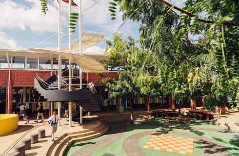
范莎学院位于加拿大安大略省伦敦市,距离多伦多和尼亚加拉大瀑布以及美国底特律仅两小时车程。加拿大伦敦市本身就是一个美丽的学习地点--被誉为 "森林城市",拥有众多公园和湖泊,同时也是一个繁荣的文化和商业中心。范莎学院目前有超过4万名学生,其中超过1.2万名是来自140个不同国家的国际学生。范莎学院提供超过170个以职业为导向的课程,其中包括100多个与毕业工签(PGWP)挂钩的课程。范莎学院体验通过灵活的途径提供以职业为重点的优质课程,以支持学生实现个人职业目标和人生成功。其独特的体验式学习环境为学生在课堂之外取得成功奠定了基础。范莎学院各校区总共开设了 170 多门学位、文凭和证书课程。除伦敦主校区外,还有位于西姆科、伍德斯托克和圣托马斯的其他校区。伦敦校区位于牛津街校区。该校区占地 100 英亩,风景优美,拥有一流的学习和体育娱乐设施。住宿选择包括校内宿舍、私人租房以及寄宿家庭。伦敦全日制学生可享受公交卡以及学生健康中心的服务。学院为学生提供超过 500 万加元的奖学金,其中部分奖学金专门提供给国际学生。学生还可以利用合作学习选项,其中包括带薪工作,这样学生就可以 "边学边赚"。范莎学院的学生为职业生活做好了充分准备,许多学生在毕业后的六个月内就找到了工作。范莎学院校友会拥有 20 多万名毕业生,为所有在学院学习的学生建立了持久的全球联系。
本校相关课程

国际商务管理研究生证书
学历文凭
Graduate Certificate
开学日期
课程费用总额


室内装饰文凭
学历文凭
Bachelor Degree
开学日期
课程费用总额


Internet应用程序和Web开发文凭
学历文凭
Bachelor Degree
开学日期
课程费用总额


新闻学文凭-广播
学历文凭
Bachelor Degree
开学日期
课程费用总额


景观设计高级文凭
学历文凭
Bachelor Degree
开学日期
课程费用总额


法律文员文凭
学历文凭
Bachelor Degree
开学日期
课程费用总额

其他相关课程

空间分析硕士
 多伦多都会大学
学历文凭
Masters Degree
开学日期
课程费用总额


地理信息系统研究生证书-地理空间管理
 尼亚加拉学院
学历文凭
Graduate Certificate
开学日期
课程费用总额


地理信息系统与遥感证书
 约克大学
约克大学学历文凭
Bachelor Degree
开学日期
课程费用总额


荣誉地理信息系统科学学士学位-密西沙加
 多伦多大学
多伦多大学学历文凭
Bachelor Degree with Honours
开学日期
课程费用总额


地理学(荣誉)文学士学位
 卡尔顿大学
卡尔顿大学泰晤士高等教育世界大学排名:511
学历文凭
Bachelor Degree with Honours
开学日期
课程费用总额


地理信息系统研究生证书-制图专家
 弗莱明学院
弗莱明学院学历文凭
Graduate Certificate
开学日期
课程费用总额


