


Graduate Certificate in Geospatial Analysis

 美国
美国
学历文凭
Graduate Certificate

专业院系
Department of Sustainability & Environment

开学时间

课程时长

课程学费

国际学生入学条件
Baccalaureate degree or an equivalent degree from an institution with institutional accreditation for that degree. A minimum undergraduate cumulative GPA of 2.7 on conferred degree and/or graduate cumulative GPA of 3.0 or better, based on a 4.0 scale, on all graduate coursework is required for full admission.
Applicants with degrees from countries other than the United States who have obtained a high school diploma, undergraduate or graduate degree from an institutionally accredited American college or university or from an accredited institution in the approved list of English-speaking countries are not required to submit an approved English proficiency exam score. For all other applicants with degrees from other countries, a minimum score of 79 on the Internet-Based TOEFL (iBT), 550 on the Paper-Based TOEFL (PBT), 8.5 on the TOEFL Essentials, 6.0 on the IELTS Academic, 53 on the PTE, or 110 on Duolingo is required for graduate admission.
Applicants are required to submit a statement of purpose.
IDP—雅思考试联合主办方

雅思考试总分
6.0
- 雅思总分:6
- 托福网考总分:79
- 托福笔试总分:550
- 其他语言考试:Pearson Test of English (PTE) 53 or higher
CRICOS代码:
申请截止日期: 请与IDP联系 以获取详细信息。
课程简介
相关申请
 预科
预科- 奖学金
- 实习机会
- 在校学习
 跨境学习
跨境学习- 校园授课-线上开始
- 在线/远程学习
开学时间&学费
学费信息仅供参考,请与IDP联系以获取详细信息
| 开学时间 | 时长 | 学费 | 地点 |
|---|
学校排名

世界排名601
数据源:
泰晤士高等教育世界大学排名
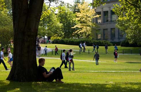
关于南达科他大学

南达科他大学(University of South Dakota,USD)成立于1862年,位于南达科他州弗米利恩。学校是一所四年制公立小型综合性大学。南达科他大学是南达科他州一所历史悠久的公立大学,也是南达科他州立大学系统成员大学之一,拥有该州唯一的法学院,医学院和艺术学院,由老校区和Al Neuharth 媒体中心组成 据《耶鲁大学日报大学指南》指出,学生认为该大学的商科最好,美术也不错。南达科他大学在超过15年的时间里都被列入头等博士研究院,并且它的医学、法学和美术学院也被国际上广泛地认可,称之为U家。 南达科他大学设有文理学院、Beacom 商学院、教育学院、美术学院、卫生科学院、法学院和Sanford 医学院,荣誉课程和研究生院。学校学科齐全,费用较低,属于物美价廉的大学。 《美国新闻与世界报道》评为四级国家级大学,学术声誉全美排第193名。 著名校友包括美国国家广播电视公司(NBC)之首席主播Tom Brokaw,及哥伦比亚电视公司(CBS) 体育实况转播者Pat O'Brien。
本校相关课程

社会工作硕士-常规职位
学历文凭
Masters Degree
开学日期
课程费用总额

历史文学硕士
学历文凭
Masters Degree
开学日期
课程费用总额

Master of Arts in English (Thesis)
学历文凭
Masters Degree
开学日期
课程费用总额

Master of Arts in Secondary Education
学历文凭
Masters Degree
开学日期
课程费用总额

Master of Science in Technology for Education and Training
学历文凭
Masters Degree
开学日期
课程费用总额

Master of Arts in Special Education
学历文凭
Masters Degree
开学日期
课程费用总额
其他相关课程
地球科学哲学博士
 滑铁卢大学
滑铁卢大学学历文凭
Ph.D.
开学日期
课程费用总额

地球科学(荣誉)理学学士
圣弗朗西斯泽维尔大学学历文凭
Bachelor Degree with Honours
开学日期
课程费用总额

环境地球科学(荣誉)理学学士
阿卡迪亚大学学历文凭
Bachelor Degree
开学日期
课程费用总额
环境地球科学理学学士
阿卡迪亚大学学历文凭
Bachelor Degree
开学日期
课程费用总额

地球科学理学硕士
布鲁克大学学历文凭
Masters Degree
开学日期
课程费用总额

哲学地质科学博士
曼尼托巴大学学历文凭
Ph.D.
开学日期
课程费用总额