

专业咨询留学:400-697-9728
服务监督热线:400-821-8688


地理理科文凭-地理信息系统
Graduate Certificate in Geographic Information Systems
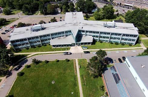
 加拿大
加拿大
学历文凭
Graduate Certificate

专业院系

开学时间

课程时长

课程学费

国际学生入学条件
Diploma or undergraduate degree in a related field of study such as geographic information systems (GIS), archeology, geography, forestry, geology, resource management, urban planning, science, engineering, computer science, marketing, commerce, economics or business administration.
International students – Submit your official post-secondary documents for assessment.
Copy of board-attested or direct-issued Certificate issued by All India – Central Board of Secondary Education (CBSE), All India – Council for the Indian School Certificate Examinations (CISCE), National Institute of Open Schooling (NIOS), or State Boards of Higher Secondary Education.
Copy of Statement of Marks/Mark Sheet for Grade 12. School-issued transcripts/records with marks are not acceptable.
Official transcripts – You must submit your official transcript(s) for courses required for admission.
International English Language Testing Systems (IELTS Academic Test) – minimum score of 6.0 on each test (Listening, Reading, Writing, Speaking).
Test of English as a Foreign Language (TOEFL) – minimum test scores of 80 on the Internet-Based Test (TOEFL® iBT), 60 on the Paper-Delivered Test, or 550 on the Paper-Based Test.
Canadian Test of English for Scholars and Trainees (CanTest) – average score of 4.5.
Canadian Language Benchmark (CLB) – minimum Level 8 on each test. Canadian Language Benchmarks Placement Test (CLBPT) is not accepted.
Canadian Academic English Language Assessment (CAEL) – minimum Band 60.
Michigan English Test (MET) – minimum score 59.
展开
IDP—雅思考试联合主办方

雅思考试总分
6.0
了解更多
雅思考试指南
- 雅思总分:6
- 托福网考总分:80
- 托福笔试总分:550
- 其他语言考试:Pearson Test of English Academic (PTE) – minimum test score of 55.
CRICOS代码:
申请截止日期: 请与IDP顾问联系以获取详细信息。
课程简介
地理信息系统专业是地理理科文凭课程的第二年选项。地理信息系统(GIS)是世界上增长最快的技术领域之一。借助GIS,技术用户可以链接和分析空间数据集,以对现实世界进行建模,以支持决策过程。通过为您提供必不可少的GIS技能以及它们如何应用于环境,市政和资源管理项目,您可以集中精力进行准备。您参与了一系列的地理活动,包括使用GPS和遥感收集地理空间数据,以及在各种学科中存储,操纵,分析,解释和传达地理信息。
This graduate certificate is an intensive post-graduate level program designed to provide you with a sound basis in geographic information management systems.<br>You learn to:<br>Manage, manipulate and analyze data with a variety of geographic information systems (GIS)-based software<br>Use GIS technology in your area of interest, for example: biology, ecology, forestry, geology<br>Use remote sensing techniques, including image analysis and the transfer and incorporation of remotely sensed data into a GIS database<br>Develop customized applications using programming languages to automate geoprocessing tasks/analysis and deploy web mapping solutions<br>This program has a strong connection to geomatics programming and industry. It also leverages the expertise of the Applied Geomatics Research Group.<br>Career options<br>Graduates are qualified to work as GIS specialists, GIS analysts, GIS application programmers, GIS developers, spatial database managers, or other related occupations.<br>Graduates are employed in small and large business, governments, academia and not-for-profits across Nova Scotia and around the world.
This graduate certificate is an intensive post-graduate level program designed to provide you with a sound basis in geographic information management systems.<br>You learn to:<br>Manage, manipulate and analyze data with a variety of geographic information systems (GIS)-based software<br>Use GIS technology in your area of interest, for example: biology, ecology, forestry, geology<br>Use remote sensing techniques, including image analysis and the transfer and incorporation of remotely sensed data into a GIS database<br>Develop customized applications using programming languages to automate geoprocessing tasks/analysis and deploy web mapping solutions<br>This program has a strong connection to geomatics programming and industry. It also leverages the expertise of the Applied Geomatics Research Group.<br>Career options<br>Graduates are qualified to work as GIS specialists, GIS analysts, GIS application programmers, GIS developers, spatial database managers, or other related occupations.<br>Graduates are employed in small and large business, governments, academia and not-for-profits across Nova Scotia and around the world.
展开
相关申请
 预科
预科 奖学金
奖学金- 实习机会
- 在校学习
- 跨境学习
- 校园授课-线上开始
- 在线/远程学习
本校相关课程

学术和职业联系证书
学历文凭
Bachelor Degree
开学日期
课程费用总额

成就证书
学历文凭
Bachelor Degree
开学日期
课程费用总额

成瘾社区外展高级文凭
学历文凭
Graduate Certificate
开学日期
课程费用总额

飞机维修工程师文凭(航空电子)
学历文凭
Bachelor Degree
开学日期
课程费用总额
飞机维修工程师文凭(机械)
学历文凭
Bachelor Degree
开学日期
课程费用总额

飞机维修工程师证书(结构)
学历文凭
Bachelor Degree
开学日期
课程费用总额
其他相关课程
热点资讯
成功故事
在线提交申请
请详细填写您的申请材料
请选择
请选择
请选择
请选择
请选择
IDP在取得您的同意前,将不会提供您的资讯给其他机构