


海洋测绘高级文凭
Graduate Certificate in Marine Geomatics

学历文凭
Graduate Certificate

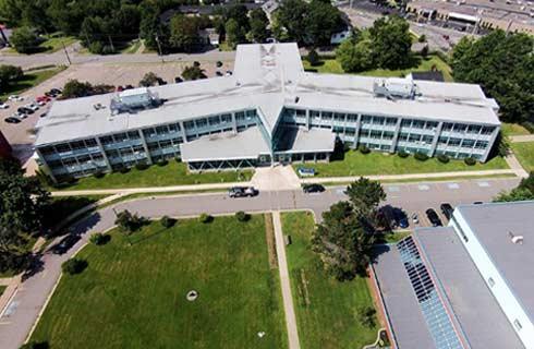
专业院系

开学时间

课程时长

课程学费

国际学生入学条件
IDP—雅思考试联合主办方

雅思考试总分
6.0
- 雅思总分:6
- 托福网考总分:80
- 托福笔试总分:550
- 其他语言考试:Pearson Test of English Academic (PTE) – minimum test score of 55.
CRICOS代码:
申请截止日期: 请与IDP联系 以获取详细信息。
课程简介
Process, analyze and interpret data captured in the terrestrial, marine and coastal environments.<br><br>In this graduate certificate program you:<br>Operate specialized acoustic mapping equipment, such multibeam echosounders and side-scan sonars, to acquire bathymetric data and detect anomalies on the seafloor<br>Install sensors on a survey vessel, configure devices and interface hardware with acquisition and navigation software<br>Manage a project from reconnaissance and planning to data acquisition and presentation of the final product<br>Set up and operate oceanographic equipment, such as tide gauges, current meters and speed of sound sensors<br>Collect three-dimensional data using the latest positioning technologies, such as Total Stations, Global Navigation Satellite System (GNSS), commonly known as global positioning systems or GPS, and LiDAR scanners<br>Present geospatial data by generating 3D digital models using the latest geographic information systems (GIS) and computer-aided drafting (CAD) software<br>This program is offered at the Centre of Geographic Sciences (COGS), Canada's largest geomatics-focused learning environment, and prepares you for a career in the global geomatics sector.<br>Career options<br>Travel the world and generally receive above average salary.<br>Work as an online surveyor, navigator/surveyor, data processor, data analyst, GIS analyst, CAD operator or land surveyor on geoscience and construction projects.<br>Be employed by federal hydrographic mapping agencies, ocean and seabed research organizations, environmental monitoring companies, offshore construction and engineering firms, land and construction survey companies and other private surveying and engineering firms and public sector organizations.<br>Graduates are involved in numerous activities related to coastal and offshore projects, including:<br>Performing bathymetric surveys and creating nautical charts<br>Assisting engineering companies determine the feasibility and routing of offshore cables and pipelines<br>Seabed investigations for, and installation of, offshore windmills<br>Navigating vessels for offshore construction activities, such as bridges and platforms<br>Assisting with the positioning of remotely operated vehicles, autonomous underwater vehicles and unmanned surface vehicles for seabed mapping and geophysical investigations<br>Providing survey services for mapping the coastal areas for erosion and environmental applications
相关申请
 预科
预科 奖学金
奖学金- 实习机会
- 在校学习
- 跨境学习
- 校园授课-线上开始
- 在线/远程学习
开学时间&学费
学费信息仅供参考,请与IDP联系以获取详细信息
| 开学时间 | 时长 | 学费 | 地点 |
|---|
本校相关课程

学术和职业联系证书
学历文凭
Bachelor Degree
开学日期
课程费用总额

成就证书
学历文凭
Bachelor Degree
开学日期
课程费用总额

成瘾社区外展高级文凭
学历文凭
Graduate Certificate
开学日期
课程费用总额

飞机维修工程师文凭(航空电子)
学历文凭
Bachelor Degree
开学日期
课程费用总额

飞机维修工程师文凭(机械)
学历文凭
Bachelor Degree
开学日期
课程费用总额
飞机维修工程师证书(结构)
学历文凭
Bachelor Degree
开学日期
课程费用总额
其他相关课程
海洋与海军工程哲学博士
 纽芬兰纪念大学
学历文凭
Ph.D.
开学日期
课程费用总额

海洋工程技术证书
 西雅图中央社区学院
学历文凭
Advanced Certificate
开学日期
课程费用总额

Master of Science in Engineering (Thesis) - Naval Architecture and Marine Engineering
新奥尔良大学学历文凭
Masters Degree
开学日期
课程费用总额

海洋甲板技术证书
西雅图中央社区学院学历文凭
Advanced Certificate
开学日期
课程费用总额

海军建筑与海洋工程工程学硕士
不列颠哥伦比亚大学学历文凭
Masters Degree
开学日期
课程费用总额

Master of Science in Engineering (Non-Thesis) - Naval Architecture and Marine Engineering
新奥尔良大学学历文凭
Masters Degree
开学日期
课程费用总额