地理学学士学位(地理信息系统和分析)
Bachelor of Arts in Geography (Geographic Information Science)

学历文凭
Bachelor Degree

专业院系
College of Natural Sciences and Mathematics

开学时间

课程时长

课程学费

国际学生入学条件
Applicant must have High School Transcript with minimum 3.0 out of 4.0 scale or average 80% marks or High School Diploma transcript.
English Language Proficiency Requirement: TOEFL: 64 iBT; IELTS: 6.0; DuoLingo: 95; Sacramento State ELI: Level 7; PTE Academic: 50; GTEC: 1125; ELS Language Center: Level 112; FLS Language School: Level 16; TLC: Level 9; UCLA Extension: Level 6.
The filing periods for each intake are: Fall Intake Application Filing Period: October 1 – June 1; Spring Intake Application Filing Period: August 1 – Nov 15.
IDP—雅思考试联合主办方

雅思考试总分
6.0
- 雅思总分:6
- 托福网考总分:64
- 托福笔试总分:510
- 其他语言考试:PTE Academic-50 DuoLingo-95
CRICOS代码:
申请截止日期: 请与IDP联系 以获取详细信息。
课程简介
The Bachelor of Arts in Geography with a concentration in Geographic Information Science (GIScience) emphasizes student development of geospatial skills. Geographic Information Science, cartography, remote sensing, and qualitative and quantitative methods prepare students to tackle any problem with a spatial dimension—from advising an individual firm on good locations for a new branch or supplier to modeling the spread of wildfires across a region to analyzing the global spread of diseases or new technologies.<br>Geography students at Sacramento State explore Earth’s natural and cultural environments using methods from the natural sciences and the social sciences. They study climate, weather, landforms, water resources, and plants and animals, as well as peoples, societies, economies, and cities. These phenomena overlap in intricate ways, giving rise to distinctive places and regions. Geography’s approach emphasizes Earth’s spatial relationships and patterns, and the processes that govern them, whether found in nature or in human behavior. <br><br>Students work with quantitative and qualitative data from a variety of sources, including published censuses and maps, aerial imagery, field and lab work, surveys, and interviews. They use a variety of tools, including Global Positioning Systems (GPS), Geographic Information Systems (GIS), and other computer applications to collect, display, and analyze spatial data. Geography students study and address complex issues, especially those with a human-environment interface, such as climate change, resource management, urban growth and design, globalization, immigration, ethnic identity, and territorial conflict. Geographical understanding is applied at different scales, from the local to the global, and regional expertise is cultivated.
相关申请
 预科
预科 奖学金
奖学金 实习机会
实习机会 在校学习
在校学习 跨境学习
跨境学习 校园授课-线上开始
 在线/远程学习
开学时间&学费
学费信息仅供参考,请与IDP联系以获取详细信息
| 开学时间 | 时长 | 学费 | 地点 |
|---|
关于加州州立大学萨克拉门托分校

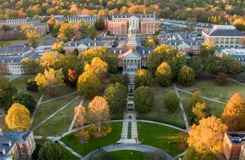
加州州立大学萨克拉门托分校(通常简称 CSUS 或萨克拉门托州立)坐落于萨克拉门托市中心,为学生提供了一个充满活力和生机的学习环境,促进了学生的学业成绩和个人成长。萨克拉门托州立的悠久历史可追溯到 1947 年,现已发展成为一所以致力于提供高质量教育和创新研究而闻名的著名学府。在萨克拉门托州立,学生可以选修各种学科的本科和研究生课程,包括艺术、商业课程、工程学、健康科学等。这些课程旨在让学生掌握在当今竞争激烈的全球市场中取得成功所需的知识、技能和经验。大学拥有一支经验丰富的专业教师团队,他们对教学和指导学生充满热情。通过小班授课和互动式教学,教师们为学生提供个性化的关注和支持,确保每个学生都能获得实现目标所需的指导。萨克拉门托州立位于加利福尼亚州首府,为学生提供了一个充满活力的校园社区,并为学生提供了丰富的文化、娱乐和职业机会。无论是游览市内的博物馆、公园和餐馆,还是与行业专业人士和社区领袖交流,萨克拉门托州立的学生都能从真正丰富多彩、身临其境的大学生活中受益。
本校相关课程

美国手语/聋人研究文学士
学历文凭
Bachelor Degree
开学日期
课程费用总额


人类学文学士(考古学和生物人类学)
学历文凭
Bachelor Degree
开学日期
课程费用总额


人类学文学士(文化,语言和社会)
学历文凭
Bachelor Degree
开学日期
课程费用总额


人类学文学士(普通人类学)
学历文凭
Bachelor Degree
开学日期
课程费用总额


艺术教育学士学位(单科预备课程)
学历文凭
Bachelor Degree
开学日期
课程费用总额


艺术学士学位(艺术史)
学历文凭
Bachelor Degree
开学日期
课程费用总额

其他相关课程

空间分析硕士
 多伦多都会大学
学历文凭
Masters Degree
开学日期
课程费用总额


地理信息系统研究生证书-地理空间管理
 尼亚加拉学院
学历文凭
Graduate Certificate
开学日期
课程费用总额


地理信息系统与遥感证书
 约克大学
约克大学学历文凭
Bachelor Degree
开学日期
课程费用总额


荣誉地理信息系统科学学士学位-密西沙加
 多伦多大学
多伦多大学学历文凭
Bachelor Degree with Honours
开学日期
课程费用总额


地理学(荣誉)文学士学位
 卡尔顿大学
卡尔顿大学泰晤士高等教育世界大学排名:511
学历文凭
Bachelor Degree with Honours
开学日期
课程费用总额


地理信息系统研究生证书-制图专家
 弗莱明学院
弗莱明学院学历文凭
Graduate Certificate
开学日期
课程费用总额


 美国
美国