服务热线:400-697-9728


地理空间数据分析高级文凭
Graduate Certificate in Geospatial Data Analytics

学历文凭
Graduate Certificate

专业院系

开学时间

课程时长

课程学费

国际学生入学条件
Diploma, advanced diploma, graduate certificate or undergraduate degree from a related area. Related areas include:
Business (including business administration, commerce, economics, marketing)
Engineering (including technology and technician programs)
Information Technology (including computer science, Health Information Management)
Geomatics (includes Geographic Information Systems, urban planning, geography, geographic sciences)
Other related areas such as archaeology, digital humanities, forestry, geology, natural sciences, resource management
Consideration will also be given to those with extensive relevant experience working in a geospatial related field who do not hold a diploma or degree as specified above.
Copy of board-attested or direct-issued Certificate issued by All India – Central Board of Secondary Education (CBSE), All India – Council for the Indian School Certificate Examinations (CISCE), National Institute of Open Schooling (NIOS), or State Boards of Higher Secondary Education.
Copy of Statement of Marks/Mark Sheet for Grade 12. School-issued transcripts/records with marks are not acceptable.
Official transcripts – You must submit your official transcript(s) for courses required for admission.
International English Language Testing Systems (IELTS Academic Test) – minimum score of 6.0 on each test (Listening, Reading, Writing, Speaking).
Test of English as a Foreign Language (TOEFL) – minimum test scores of 80 on the Internet-Based Test (TOEFL® iBT), 60 on the Paper-Delivered Test, or 550 on the Paper-Based Test.
Canadian Test of English for Scholars and Trainees (CanTest) – average score of 4.5.
Canadian Language Benchmark (CLB) – minimum Level 8 on each test. Canadian Language Benchmarks Placement Test (CLBPT) is not accepted.
Canadian Academic English Language Assessment (CAEL) – minimum Band 60.
Michigan English Test (MET) – minimum score 59.
展开
IDP—雅思考试联合主办方

雅思考试总分
6.0
- 雅思总分:6
- 托福网考总分:80
- 托福笔试总分:550
- 其他语言考试:Pearson Test of English Academic (PTE) – minimum test score of 55.
CRICOS代码:
申请截止日期: 请与IDP联系 以获取详细信息。
课程简介
获得管理,分析和解释地理空间数据所需的高级技能和知识。在增强领导团队或组织的能力的同时,对地理空间分析技术,应用程序和平台有更深入的了解。在此程序中,您将学习如何:管理,解释,分析和过滤大量相关数据,以制定更准确,可靠的业务决策。制定具有目标和范围的项目计划,以提高效率和衡量进度。使用数据分析来抓住商机,并激励您的团队提高绩效。<br>使用技术和商业知识来解决地理空间问题并消除业务成功的障碍。<br>随着越来越多的公司将地理空间信息系统应用程序与地图数据结合起来,在新斯科舍省市场中的竞争优势。
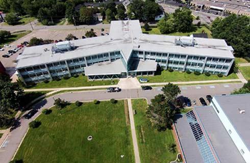
In this graduate certificate program, you combine advanced geographic information systems (GIS) with data analytics to solve challenging, real-world problems. Using cutting edge geospatial tools, you'll learn how to discover new and valuable insights in data. You blend the art and science of data visualization to communicate results to stakeholders, and connect with industry partners and post-secondary institutions to work on real-world projects.<br><br>You learn to: Design interactive dashboards and data visualizations, Apply machine learning and deep learning to uncover new insights in geospatial data, Develop custom GIS and data analytics solutions to solve complete geospatial problems<br>Use artificial intelligence to analyze imagery and other geospatial data<br>This program is offered at the Centre of Geographic Sciences (COGS), Canada's largest geomatics-focused learning environment, and prepares you for a career in the global geomatics sector.<br>Career options<br>Graduates of this program are in high demand. They find employment as: Data Analysts, Data analytics specialists<br>Geospatial data interpretation analysts, Geographic information systems analysts, Applications specialists<br>Spatial data managers, Entrepreneurs in a geospatial field
In this graduate certificate program, you combine advanced geographic information systems (GIS) with data analytics to solve challenging, real-world problems. Using cutting edge geospatial tools, you'll learn how to discover new and valuable insights in data. You blend the art and science of data visualization to communicate results to stakeholders, and connect with industry partners and post-secondary institutions to work on real-world projects.<br><br>You learn to: Design interactive dashboards and data visualizations, Apply machine learning and deep learning to uncover new insights in geospatial data, Develop custom GIS and data analytics solutions to solve complete geospatial problems<br>Use artificial intelligence to analyze imagery and other geospatial data<br>This program is offered at the Centre of Geographic Sciences (COGS), Canada's largest geomatics-focused learning environment, and prepares you for a career in the global geomatics sector.<br>Career options<br>Graduates of this program are in high demand. They find employment as: Data Analysts, Data analytics specialists<br>Geospatial data interpretation analysts, Geographic information systems analysts, Applications specialists<br>Spatial data managers, Entrepreneurs in a geospatial field
展开
相关申请
 预科
预科 奖学金
奖学金- 实习机会
- 在校学习
- 跨境学习
- 校园授课-线上开始
- 在线/远程学习
开学时间&学费
学费信息仅供参考,请与IDP联系以获取详细信息
| 开学时间 | 时长 | 学费 | 地点 |
|---|
本校相关课程

学术和职业联系证书
学历文凭
Bachelor Degree
开学日期
课程费用总额

成就证书
学历文凭
Bachelor Degree
开学日期
课程费用总额

成瘾社区外展高级文凭
学历文凭
Graduate Certificate
开学日期
课程费用总额

飞机维修工程师文凭(航空电子)
学历文凭
Bachelor Degree
开学日期
课程费用总额

飞机维修工程师文凭(机械)
学历文凭
Bachelor Degree
开学日期
课程费用总额

飞机维修工程师证书(结构)
学历文凭
Bachelor Degree
开学日期
课程费用总额
其他相关课程

空间分析硕士
 多伦多都会大学
学历文凭
Masters Degree
开学日期
课程费用总额

地理信息系统研究生证书-地理空间管理
尼亚加拉学院学历文凭
Graduate Certificate
开学日期
课程费用总额

地理信息系统与遥感证书
约克大学学历文凭
Bachelor Degree
开学日期
课程费用总额

荣誉地理信息系统科学学士学位-密西沙加
多伦多大学学历文凭
Bachelor Degree with Honours
开学日期
课程费用总额

地理学(荣誉)文学士学位
卡尔顿大学泰晤士高等教育世界大学排名:511
学历文凭
Bachelor Degree with Honours
开学日期
课程费用总额

地理信息系统研究生证书-制图专家
弗莱明学院学历文凭
Graduate Certificate
开学日期
课程费用总额