


- IDP China>
- 课程库>
- 计算机科学>
- 计算机与信息科学>
- 计算机科学>
- Bachelor of Science in Computer Science and Geographical Information Science
计算机科学与地理信息科学学士学位
Bachelor of Science in Computer Science and Geographical Information Science


学历文凭
Bachelor Degree

专业院系
Faculty of Arts and Science

开学时间

课程时长

课程学费

国际学生入学条件
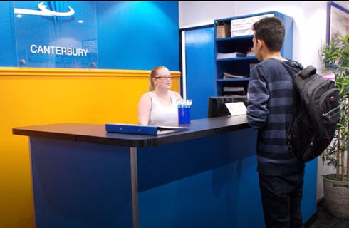
IDP—雅思考试联合主办方

雅思考试总分
6.5
- 雅思总分:6.5
- 托福网考总分:86
- 托福笔试总分:160
- 其他语言考试:Pearson Test of English (PTE) Academic score with a minimum overall score of 61, with a minimum score of 60 in each part.
CRICOS代码:
申请截止日期: 请与IDP联系 以获取详细信息。
课程简介
The Departments of Geography & Environment and Mathematics & Computer Science offer instruction leading to the multidisciplinary major in computer science and geographical information science. The program is structured to provide a firm theoretical, technical and applied background in the geographical information sciences (GIS) that draws extensively on computer science foundations.This major provides a strong basis for further study at the graduate level in an established field of research, while also providing training in an area of employment opportunity that neither the Department of Mathematics & Computer Science nor the Department of Geography & Environment alone can provide.
相关申请
 预科
预科- 奖学金
- 实习机会
- 在校学习
 跨境学习
跨境学习- 校园授课-线上开始
- 在线/远程学习
开学时间&学费
学费信息仅供参考,请与IDP联系以获取详细信息
| 开学时间 | 时长 | 学费 | 地点 |
|---|
关于莱斯布里奇大学

莱斯布里奇大学是一所位于加拿大艾伯塔省的公立综合性研究型大学,提供150多门本科课程和50门研究生课程。在2021年加拿大本科大学排名中莱斯布里奇大学位于第二,是加拿大高等教育中的一支有影响力的力量。在提供卓越的学习环境、研究创新以及国际课程和机会方面处于领先地位。该大学的莱斯布里奇校区风景如画,占地500英亩,拥有世界一流的设施。包括新建的、最先进的''科学共同体''大楼、加拿大行为神经科学中心以及艾伯塔省水与环境科学大楼。该大学还在充满活力和热情的卡尔加里市市中心地区(Calgary)设有一个校园,适合想要沉浸于加拿大生活或学习工作的学生。莱斯布里奇大学致力于通过提供出色的教学、现实世界的研究、与教授和讲师的紧密合作以及大量的娱乐和课外活动,创造超出学习者教育和个人需求的学术环境。莱斯布里奇大学的学生将发现自己充满优势,可以在学术上取得卓越成就或进入前景广阔的专业或研究领域。
本校相关课程

美术学士-艺术(艺术史和博物馆研究)
学历文凭
Bachelor Degree
开学日期
课程费用总额
美术学士-艺术(艺术工作室)
学历文凭
Bachelor Degree
开学日期
课程费用总额

原住民健康科学学士学位
学历文凭
Bachelor Degree
开学日期
课程费用总额

吸毒咨询健康科学学士学位
学历文凭
Bachelor Degree
开学日期
课程费用总额
农业生物技术理学学士
学历文凭
Bachelor Degree
开学日期
课程费用总额

农业研究学士学位
学历文凭
Bachelor Degree
开学日期
课程费用总额
其他相关课程

计算机科学哲学博士-量子信息
 滑铁卢大学
滑铁卢大学学历文凭
Ph.D.
开学日期
课程费用总额
计算机科学数学硕士-量子信息
滑铁卢大学学历文凭
Masters Degree
开学日期
课程费用总额
计算机科学哲学博士
滑铁卢大学学历文凭
Ph.D.
开学日期
课程费用总额

计算机科学理学硕士
劳伦森大学学历文凭
Masters Degree
开学日期
课程费用总额

计算机科学学士学位(3年)
劳伦森大学学历文凭
Bachelor Degree
开学日期
课程费用总额
计算机科学文学士学位(3年)
劳伦森大学学历文凭
Bachelor Degree
开学日期
课程费用总额